|
The Exchange Street Bridge to the west of McFarland is one of the first locations along the reach that could result in choked flow. As can be seen from the image to the right, the west abutment extends into the channel of the Yahara River and results in substantial channel area reduction. We estimate this distance to be about 120 feet, which is about 50% of the channel width upstream and downstream of the bridge.
|

|
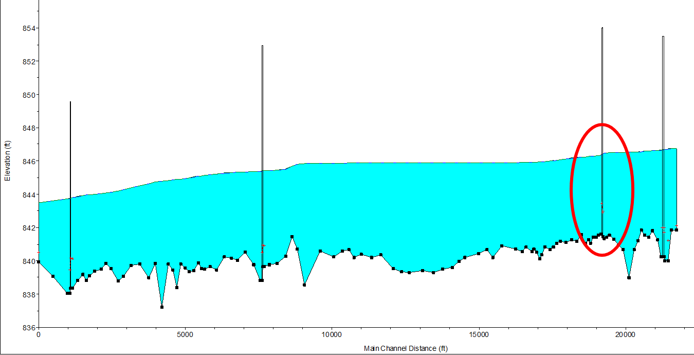
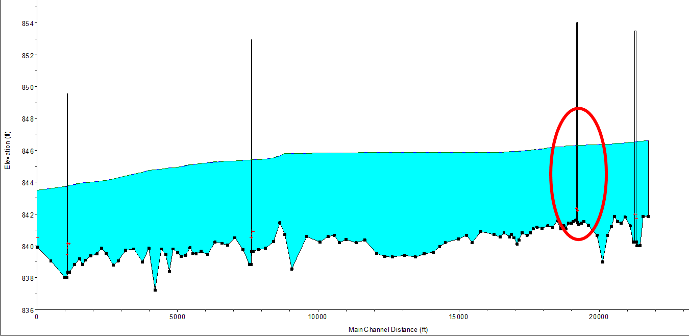
Below are the HEC-RAS cross sections for the existing bridge (left) and our proposed widening (right). The red line in the proposed cross section indicates the approximate position of the existing structure. It is important to note that our analysis was solely focused on the flow area and not on the structural stability of the bridge structure itself.

|

|
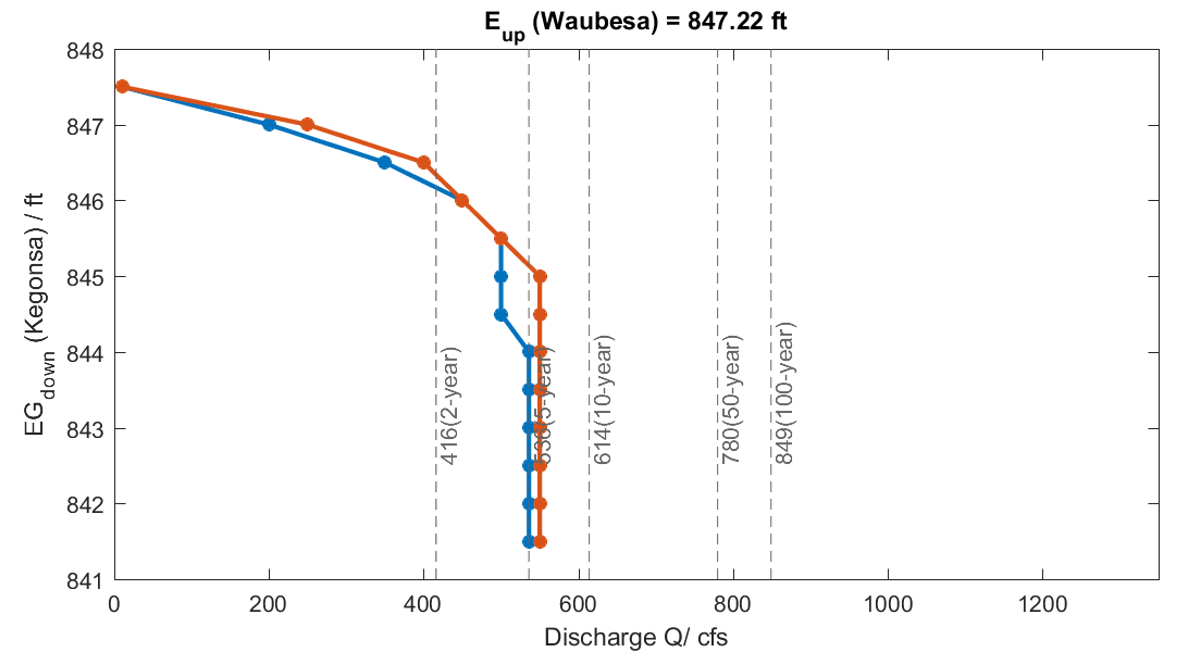
The HEC-RAS analysis with the existing bridge structure shows an increase in the water surface profile upstream of the bridge structure, which indicates choked flow is occurring.
When completing the flow analysis with the widened bridge, this profile step disappears, indicating the choke point was successfully removed.
However, when the existing and widened bridge discharges are compared for the storm in question, the discharge curves show that there would only be marginal improvements in delivery. The existing delivery curve is shown below in blue, and the curve for the widened bridge is shown in orange.
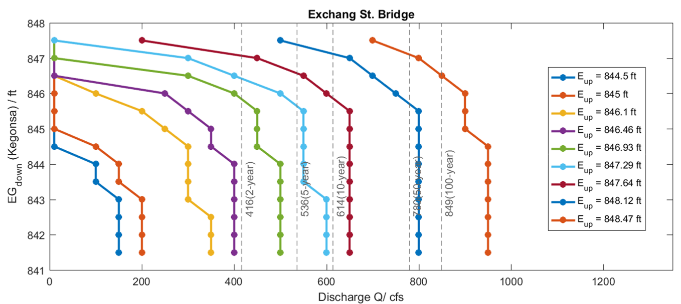
Delivery curves for a variety of flow rates are shown below.